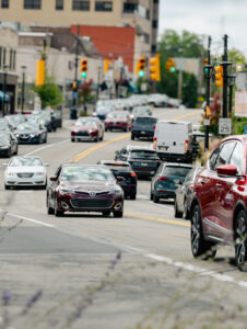
After two years of work, Mt. Lebanon and Dormont’s Active Transportation Plan (ATP) is complete. The two communities worked together to find solutions for safer roads for pedestrians and drivers of all kinds, whether behind the handlebars of a bike or the wheel of a car.
Toole Design developed the final plan, which sorted every street in both communities into five categories: passthroughs, suburban residential, urban residential, community connector and main street connector. Design elements are presented for each street type — however, the designs are purely options, not set-in-stone plans.
For example, if a resident of Lakemont Drive looks at the plan, they’ll see it’s a suburban residential street and the plan outlines design options available for that kind of street. The plan identifies sidewalks, curb extensions, and marked crossings among the choices for most appropriate elements for suburban residential streets. Other compatible elements include shared streets, intersection art or benches.
“The plan is not prescriptive,” said Mt. Lebanon Assistant Municipal Planner and Assistant Manager Ian McMeans. “Our goal was to give an array of options for people to consider when projects are done on their streets and to create a public process where residents could have input on the future design of their streets.”
The Active Transportation Plan lays out a recommended process for altering a street as follows:
- The mobility board, municipal engineer and staff identify projects and locations for consideration, typically based on upcoming street reconstruction projects or resident requests.
- Mobility board confirms the street typology.
- Mobility board leads community engagement and collects feedback from residents and staff.
- Mobility board selects a preferred design concept and recommends to the Commission for approval.
- Municipal engineer and staff develop the designs.
- The project is included in future Capital Improvement Programs for funding consideration. Once the Commission funds the project, the engineer will oversee bidding and inspections.
At the September 8 Commission discussion session, Commissioner Andrew Flynn said resident input will be crucial during the process. “What we need to do is think more broadly about ‘What are residents asking for? What do they want the street to be?’”
Next up for the ATP: the Commission will vote to adopt the plan, an education and outreach effort will inform the community about safe mobility and transportation options and the mobility board will develop a “connectivity loop” as a test project.
The ATP outlines many options for street redesign. Some of the changes are simple and can be done as “quick-build” projects, such as adding marked crossings or temporary speed bumps, while others would require extensive construction. Toole created a menu of design options for the public and officials to consider, including benches, various types of bike lanes, intersection art, curb extensions, mini roundabouts, raised crossings, textured streets, signal timing strategies and much more.
Flynn said many residents come to him asking for sidewalks or speed bumps in their neighborhood, but he believes this plan would give them other ideas to consider. “There are other solutions that can be approaches that can create a better experience for people,” he said.
Finally, Toole also created a “priority network” map that focuses on the most vulnerable road users to connect key destinations throughout the community including schools, parks, and business districts. The goal is to capture local routes used by residents, support public transit and multimodal transportation options, and explore changes to infrastructure to support better movement.